23 March 2006. See also birdseye views of Site R and the Site R sewage plant:
http://eyeball-series.org/siter-birdseye.htm
http://cryptome.org/siter-sewage.htm
24 April 2003
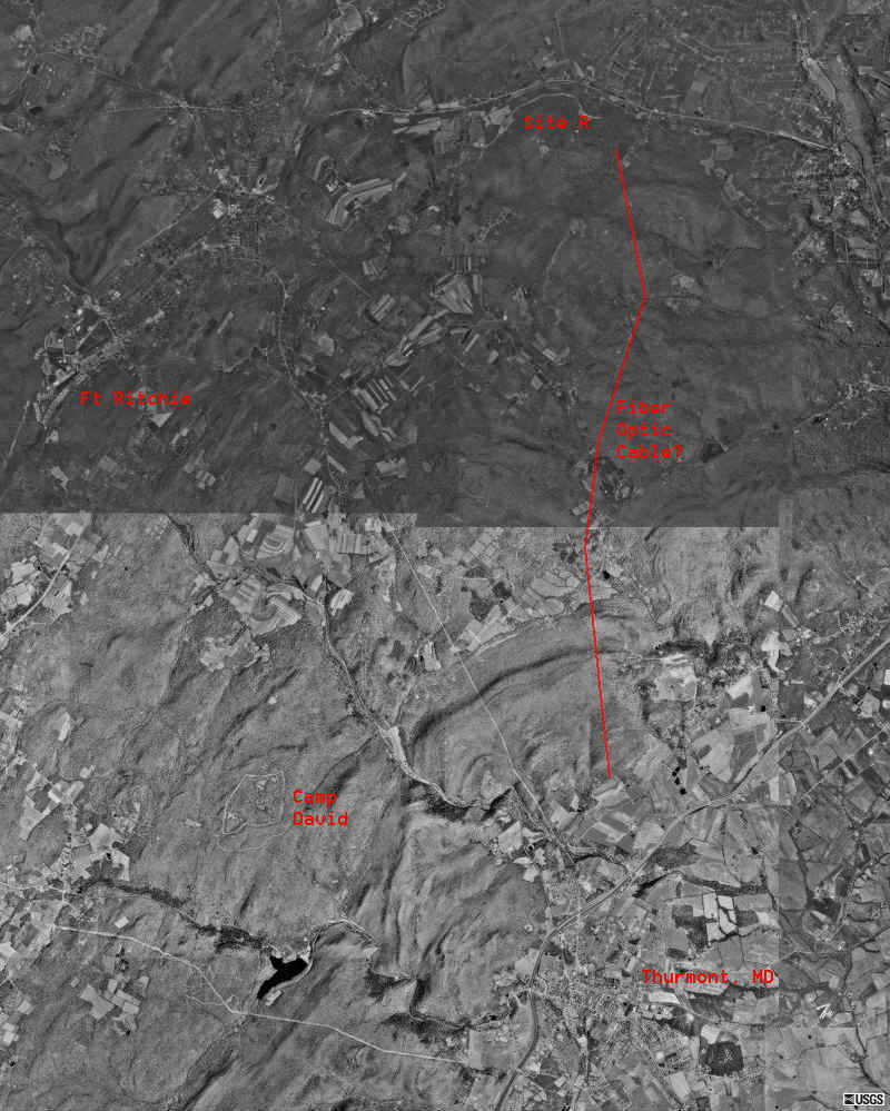
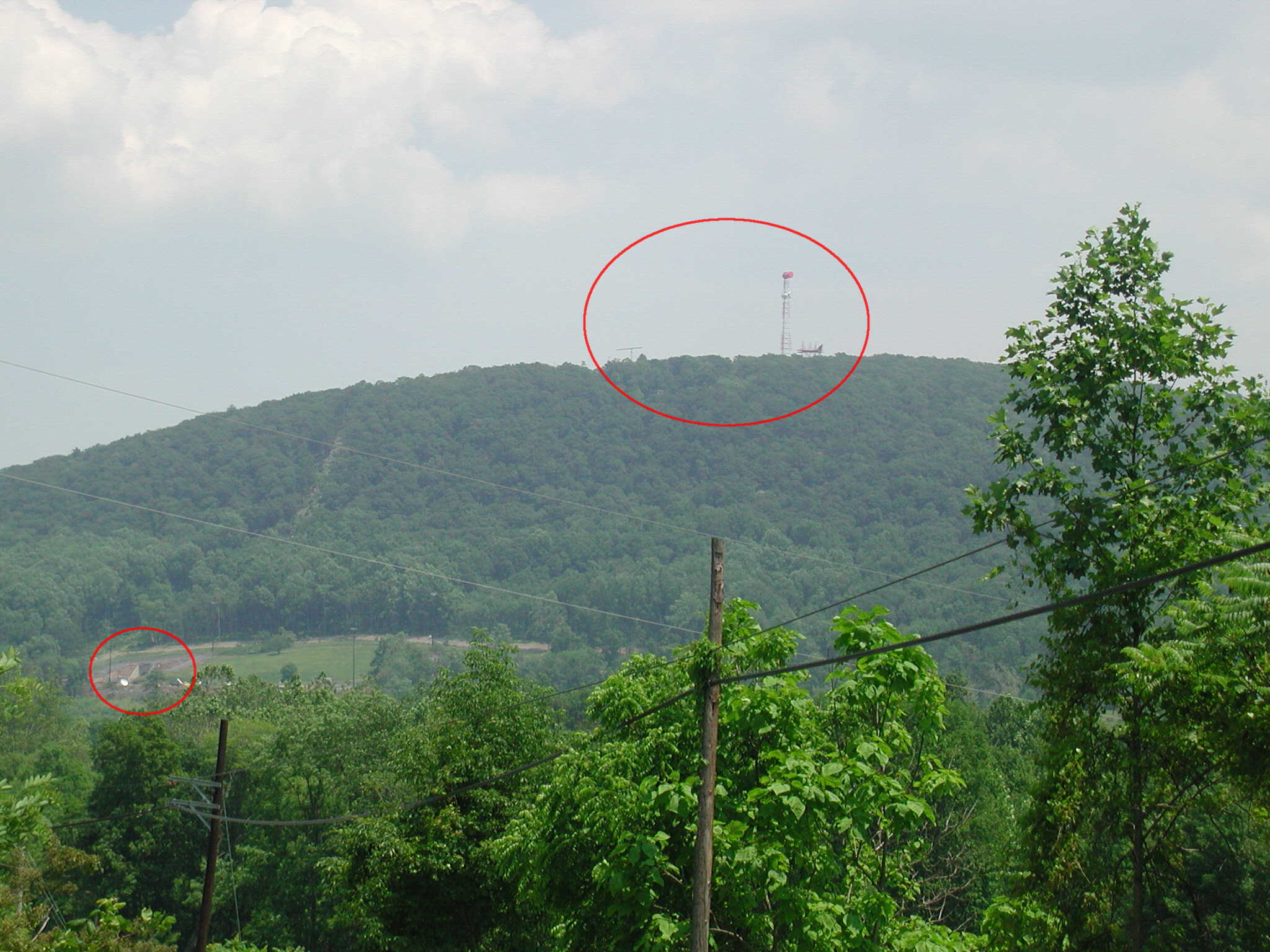
Camp David is located about 6 miles from Site R. There is surely a communications link between the two, and perhaps an underground tunnel for communications systems, servicing the systems and personnel. The link might be way of Ft Ritchie which supports Site R. Here is a map showing the three installations. To the right is what appears to be a fiber optic cable linking Site R to Thurmont, MD. There's a warning sign for the cable near a rear gate of Site R at the top of the red line (see photo below).
15 August 2002. See history of planning Site R during the Johnson Administration:
http://cryptome.org/dunmcc.htm
10 June 2002. Cryptome visited the Site R neighborhood on 9 June 2002, and took a few photos, presented below.
A note on our visit:
Private houses and farms are located just outside the gates of Site R, and a couple of residents watched us take photos but said nothing. While driving along a forest road looking for Site R gates we were startled to see a Maryland Police car following, no flashing lights, no siren. Nervous that somebody had reported our poking around the secret site, we stopped and asked the officer if that was the case. He said no, he was on his way to check on the Raven Rock Lutheran Camp which abuts Site R. We asked if there was any problem with us nosing around and he said no. Later, we remembered that Site R is in Pennsylvania and the Lutheran Camp is in Maryland.
We encountered not a single suspicious person during our visit -- other than ourselves. We suspect the site is regularly scoped by nosy nellies and the residents and the military care not a whit so long as you don't climb a fence, set off an alarm and scare yourself into needing EMS.
17 March 2002
Maps and aerial photos from Map Quest and TerraServer.
This offers information on a hardened US military communications facility, Site R (Raven Rock) Alternate Joint Communications Center (AJCC), located beneath Raven Rock mountain, near Waynesboro, PA, reported to be the bunker used by Vice President Cheney during the months after 9/11.
News report on Site R:
March 14, 2002:
http://www.citypaper.net/articles/031402/cs.cover.shtml
December 20, 2001:
http://www.s-t.com/daily/12-01/12-20-01/a02wn016.htm
December 16, 2001:
http://www.post-gazette.com/columnists/20011216homefrontp5.asp
On Mount Weather and Site R, November/December 2001:
http://www.bullatomsci.org/issues/2001/nd01/nd01schwartz.html
June 28, 2000:
http://www.newhousenews.com/archive/story1a062800.html
May 1, 2000:
http://www.fcw.com/fcw/articles/2000/0501/pol-war-05-01-00.asp
April 26, 2000:
http://www.cnn.com/2000/TECH/computing/04/26/dod.plans.online.idg/
http://www.fas.org/nuke/guide/usa/c3i/raven_rock.htmSite R is the Alternate Joint Communications Center (AJCC) located in Raven Rock mountain [hence the name Site R] just over the Pennsylvania State Line near Waynesboro, Pa. The DISA Site-R Computer Operations staff provides computer services to the NCA, the Joint Staff, the OSD and other DoD agencies through Memorandums of Agreement (MOAs). The facility functions as the disaster recovery site for the JSSC's GMC and DISA GCC. The various service [Army, Navy and Air Force] Emergency Operations Centers (AFEOC) are also located at Site R. Support is provided 24 hours per day, 7 days per week. The facility's Operations Center, DCS Technical Control Facility, the Northeast Dial Service Assistance Center and Information Center provide planning, installation, operation, and maintenance of over 38 communications systems (switching, transmission, data distribution, visual information, and power generation) that support the various customers of the Alternate Joint Communications Center Site R.
DoD description now removed from the Web, in Google cache:
http://www.google.com/search?q=cache:T4dz9XxK9DgC:www.disa.mil/jssc/jc6.html++%22site+r%22&hl=en
US Army 1111st Signal Battalion at Raven Rock ("Signal Masters of the Rock"):
http://www.asc.army.mil/1111th/1111.htm
Budget for Site R Integration Program (SRIP), 2001:
http://www.dtic.mil/descriptivesum/Y2002/DISA/0302016K.pdf
Informative Defense Data Network Management Bulletin from 1994 showing Site R's routing servers to worldwide military bases:
http://cryptome.org/bul-9411.txt
A dispute over prices at Site R eating facilities:
http://www.flra.gov/decisions/v26/26-061-3.html
See also:
Security for AJCC:
http://books.usapa.belvoir.army.mil/cgi-bin/bookmgr/BOOKS/R190_15/CCONTENTShttp://coldwardc.homestead.com/files/
http://www.sauderzone.com/ubtlinks.htm
http://www.cowan70.freeserve.co.uk/military_bases/ravens_rock.htm
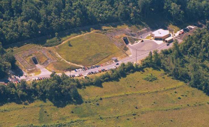
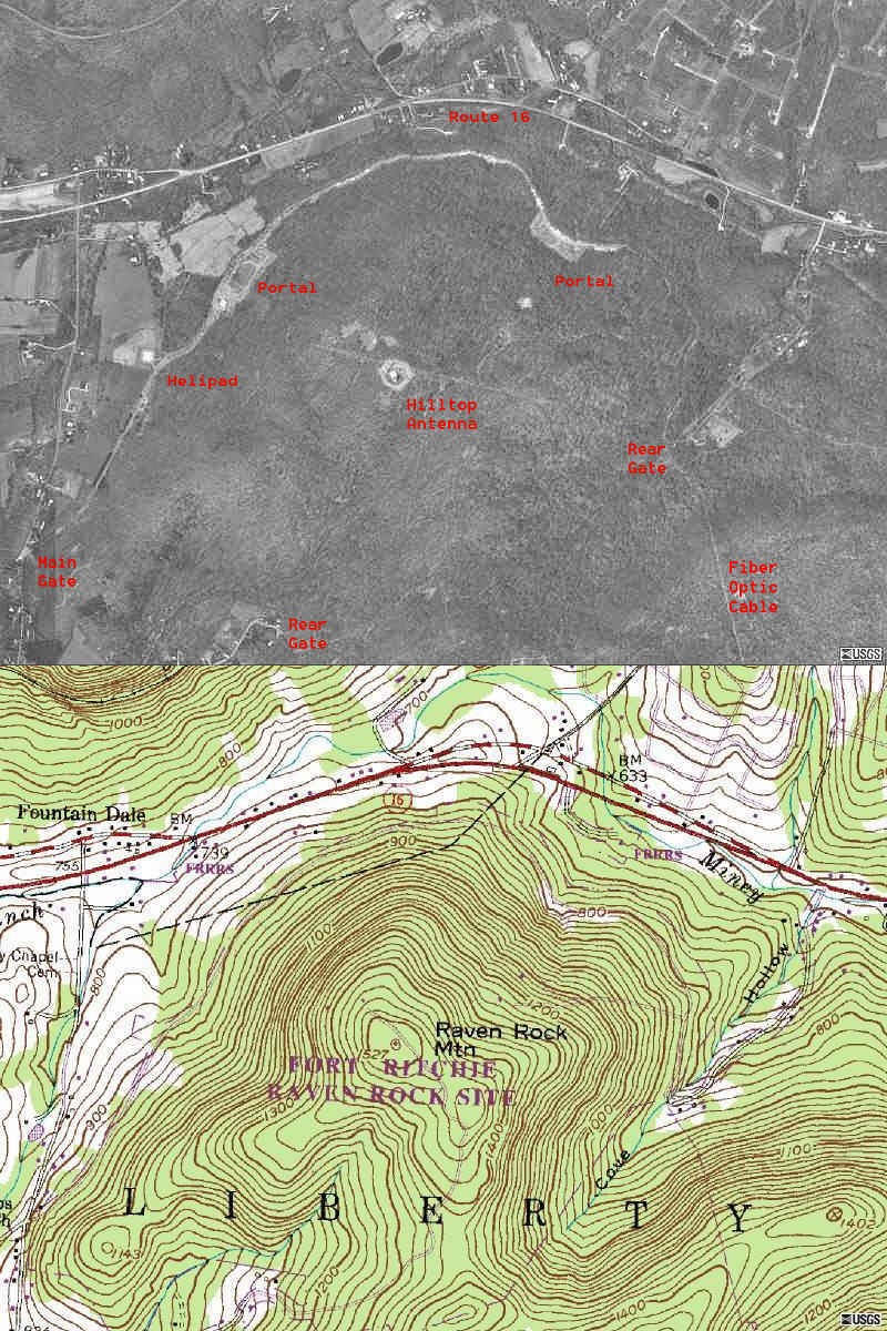
Northwest portals and guard building, perhaps with emergency service
equipment. Source for these 4 photos: http://www.angelfire.com/realm2/bushlostfl/siteR.html |
Northwest portal at right in photo at left. |
A northwest portal and guard building at left, helicopter pad at right.
|
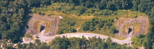
Northeast portals.
|
![[Image]](siter-photo-03.jpg) |
![[Image]](siter-map-03.jpg) |
![[Image]](siter-photo-04.jpg) |
![[Image]](siter-map-04.jpg) |
![[Image]](siter-photo-05.jpg) |
![[Image]](siter-map-05.jpg) |
![[Image]](siter-photo-06.jpg) |
![[Image]](siter-map-06.jpg) |
![[Image]](siter-photo-07.jpg) |
![[Image]](siter-map-07.jpg) |
![[Image]](siter-photo-08.jpg) |
![[Image]](siter-map-08.jpg) |
![[Image]](siter-photo-09.jpg) |
![[Image]](siter-map-09.jpg) |
![[Image]](siter-photo-10.jpg) |
![[Image]](siter-map-10.jpg) |
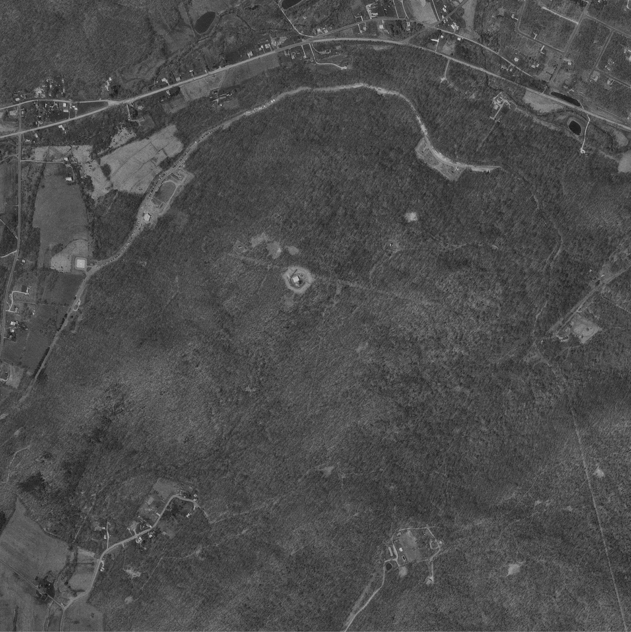
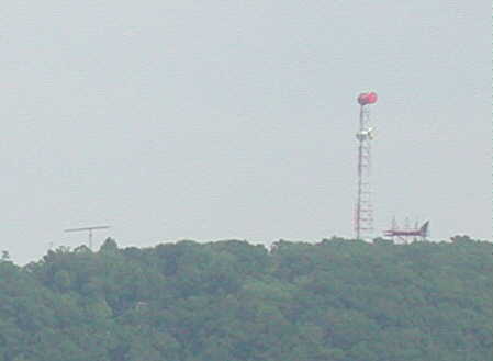
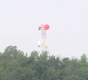
Photo shows along a curving road: a helicopter landing pad, a guard building
adjoining
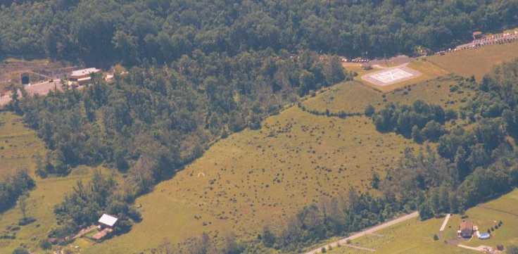
Note the faint evidence of a large four-armed cross atop the hill, each arm
several hundred yards long, Source: TerraServer, USGS photo, April 1994 |
Cryptome photos on 9 June 2002
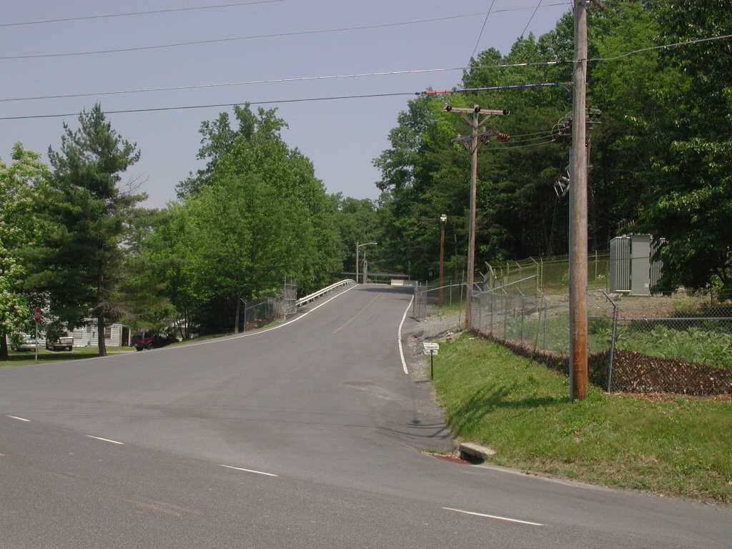
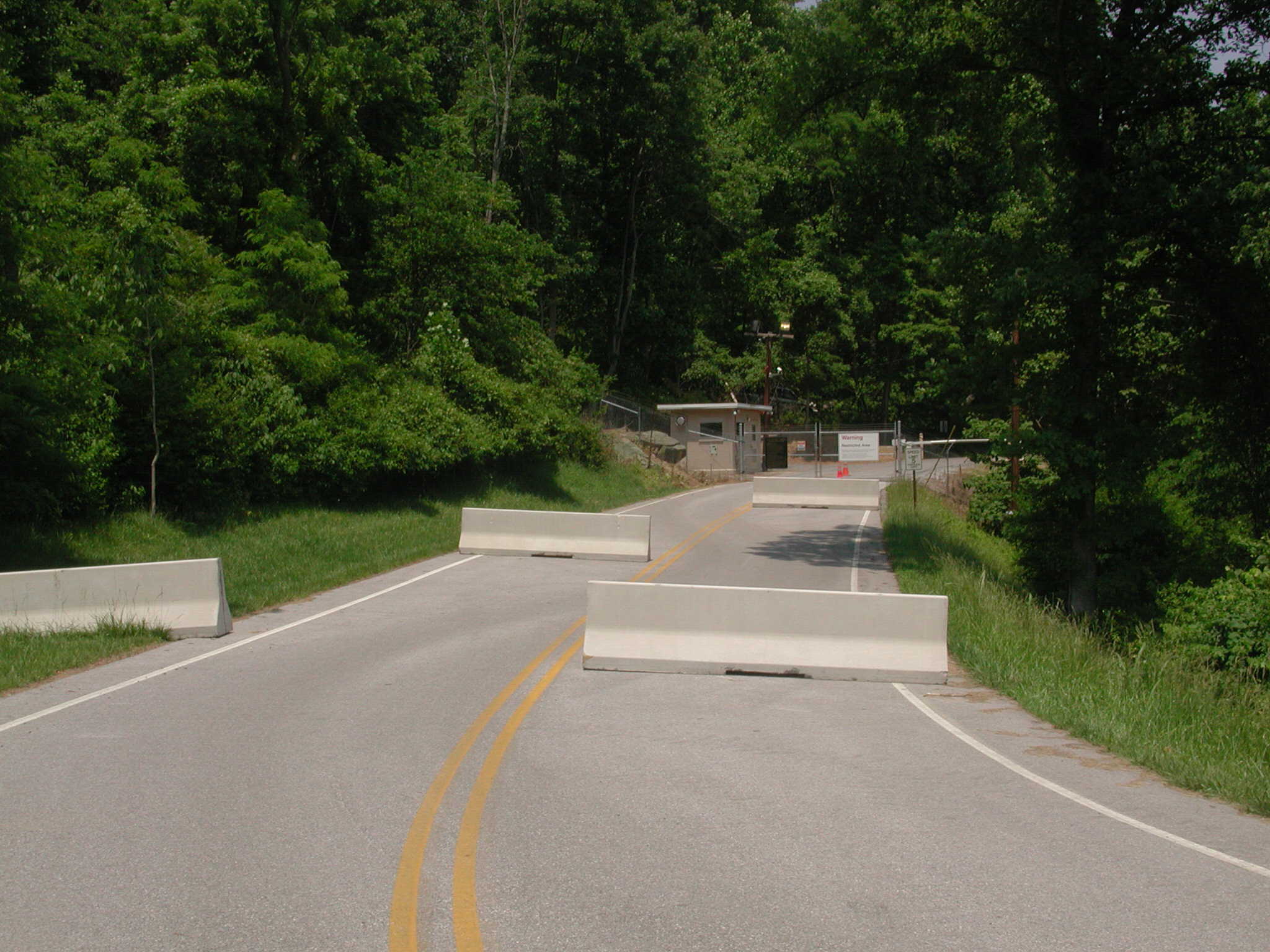
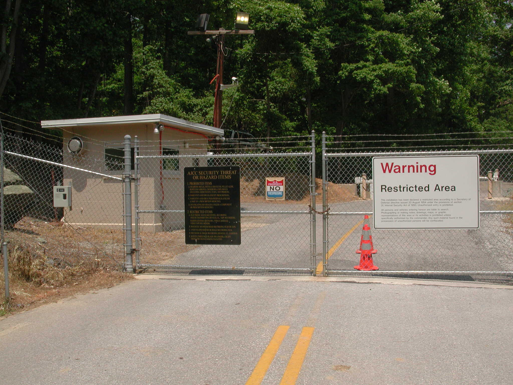
Site R entrance gate. The outer fence gate is open, and a securely closed
gate is beyond the concrete barriers in the road. Cryptome |
||||
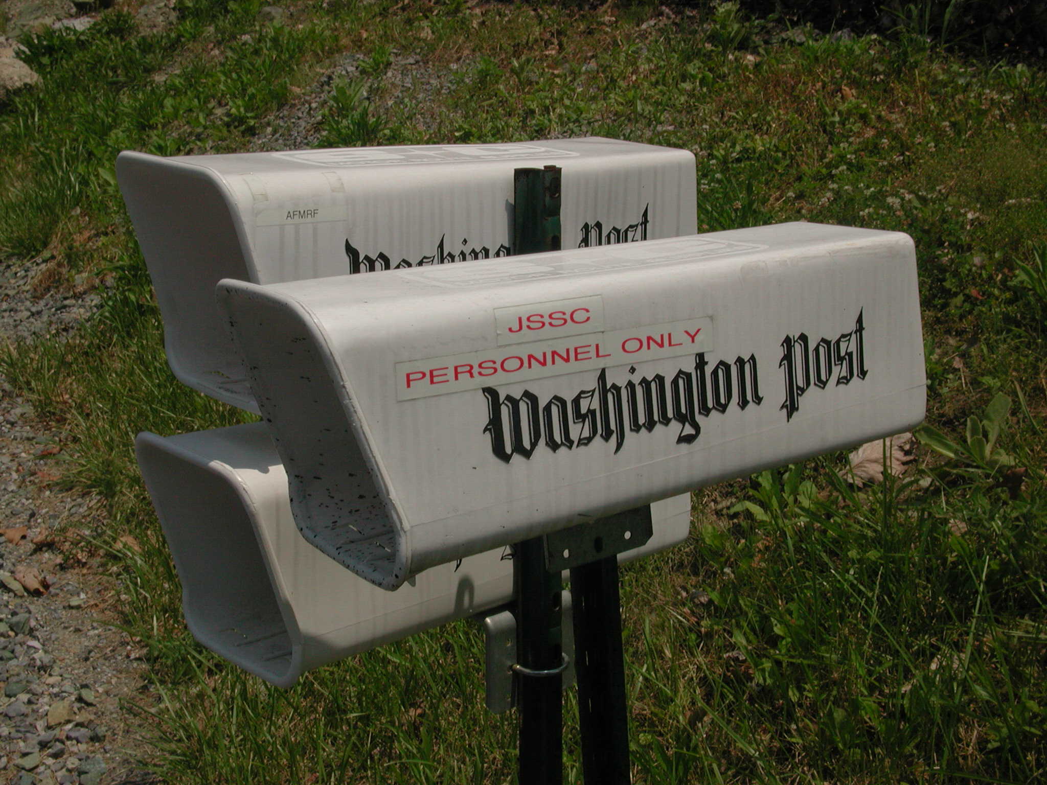
Newspaper boxes at Site R entrance. JSSC is the Joint Support Staff Center
unit at Site R, JC6 JSSC Site-R
"Guardians of the Rock." |
||||
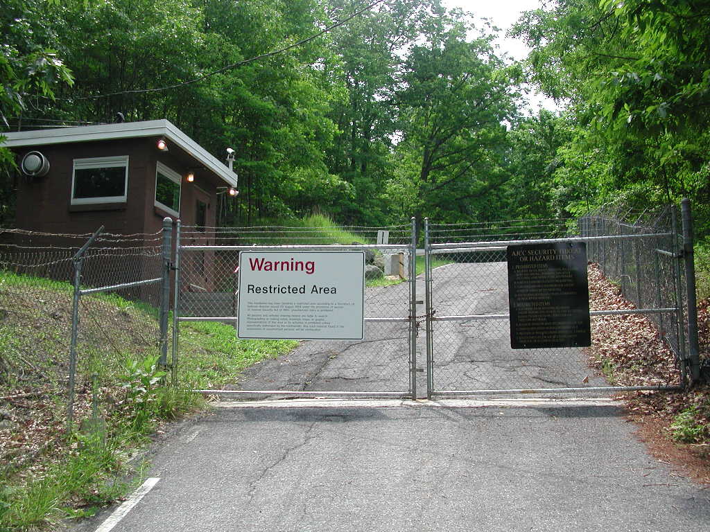
This is one of two rear gates, located on Harbaugh Valley Road (see maps) and leads to antennas on the crown of Raven Rock. |
||||
No guards were visible through the smoked, ballistic glass of the guardhouse
but may have been poised to explode Cryptome's melon. |
||||
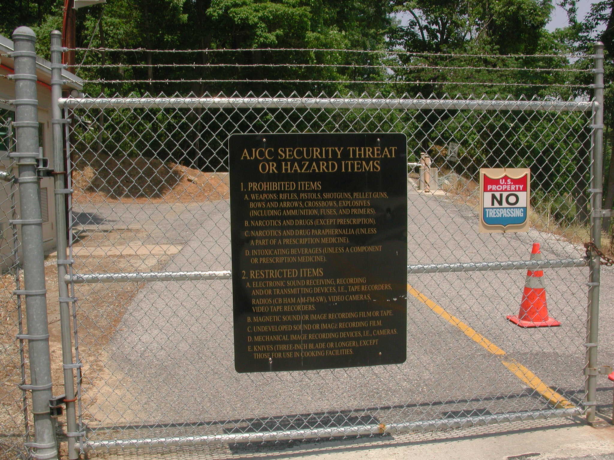
This sign is on every gate, front and two rear, along with a "Warning Restricted Area" sign. |
||||
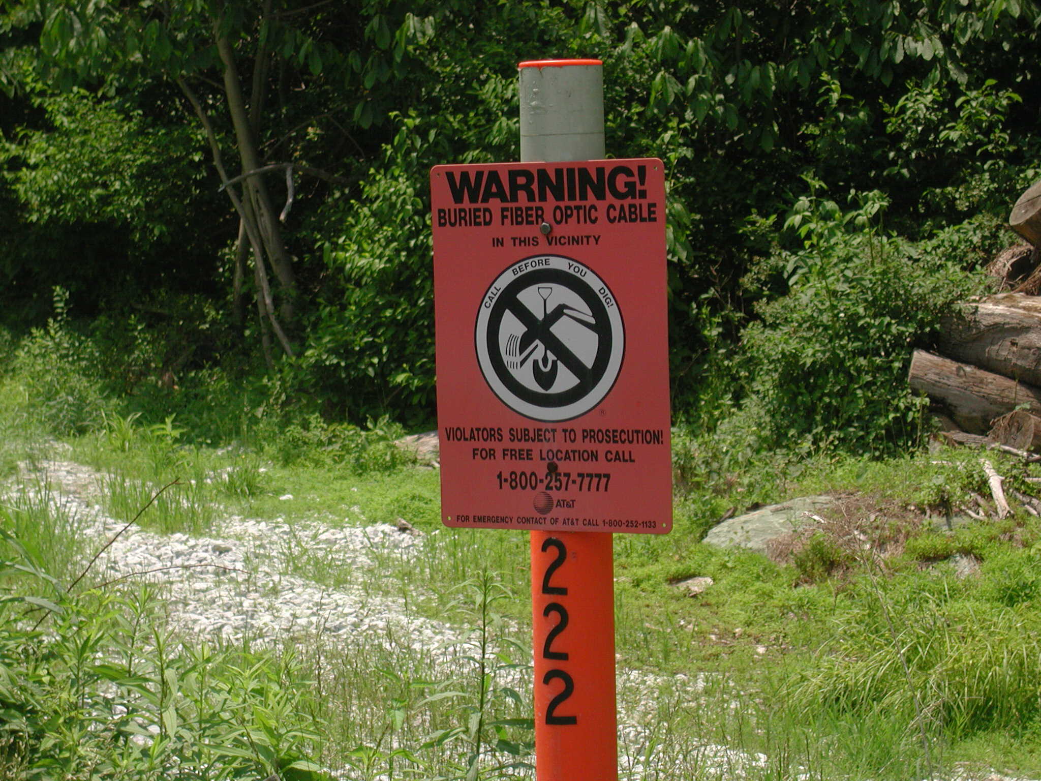
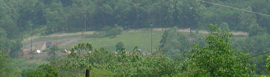
Located outside Site R perimeter fence on Harbaugh Valley Road (see maps). The fiber optic cable may have nothing to do with Site R. |
||||
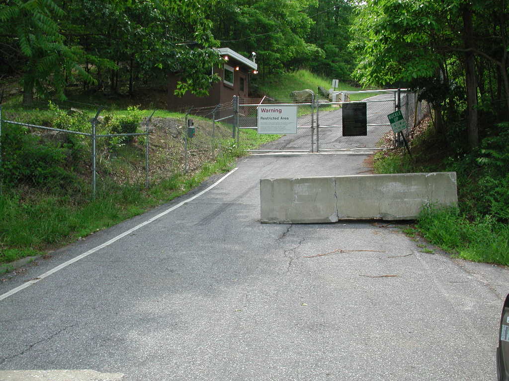
The rear gate on Cover Hollow Road (see maps), apparently a secondary
access/egress for the entrance portals. No guards |
||||
 |
||||
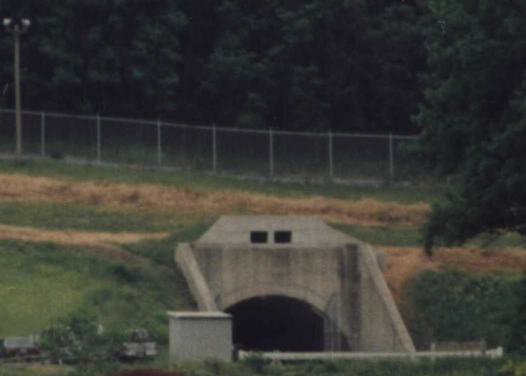
At left is one of the northwest portals, taken from
Highway 16 about a half-mile away, full photo below. |
||||
|
||||
 |
||||