Eyeballing
the
Oyster Creek Nuclear Power Station
|
This file is available on a Cryptome DVD offered by Cryptome. Donate $25 for a DVD of the Cryptome 10-year archives of 35,000 files from June 1996 to June 2006 (~3.5 GB). Click Paypal or mail check/MO made out to John Young, 251 West 89th Street, New York, NY 10024. Archives include all files of cryptome.org, cryptome2.org, jya.com, cartome.org, eyeball-series.org and iraq-kill-maim.org. Cryptome offers with the Cryptome DVD an INSCOM DVD of about 18,000 pages of counter-intelligence dossiers declassified by the US Army Information and Security Command, dating from 1945 to 1985. No additional contribution required -- $25 for both. The DVDs will be sent anywhere worldwide without extra cost. | |||
28 February 2005. One of the Eyeball series.
See also 63 US Nuclear Power Plants:
http://cryptome.org/npp/62npp-eyeball.htm
Few high-resolution satellite images of US nuclear power plants are available. Exceptions are this one at Oyster Creek, NJ, Salem-Hope Creek, NJ, Braidwood, IL, Dresden, IL, and McGuire, NC, available from USGS satellite photo coverage.
FEMA's formerly public emergency information for this plant now withdrawn
http://www.fema.gov/pte/rep/oyster.htm (now dead link)
Oyster Creek Nuclear Power StationLocation
- Lacey and Ocean Townships, New Jersey
Licensee
- General Public Utilities Nuclear Corporation
Plume (10-mile) Emergency Planning Zone Jurisdictions (now dead link)
- In New Jersey: Ocean County
Ingestion (50-mile) Emergency Planning Zone Jurisdictions
- New Jersey
Qualifying Exercise
- March 16, 1982
Chronology of Past Exercises
- May 24, 1983; May 10, 1984; June 4, 1985; May 12, 1987; June 7-8, 1989; October 22, 1991; October 19-21, 1993; October 29, 1995
Status of 350 Plan Approval (now dead link)
- Approved September 10, 1991
Status of Alert and Notification System (now dead link)
- Approved December 18, 1986
Exercise Schedule (now dead link)
Additional Plant Information [NRC's Nuclear Plant Information Books] (new, active link)
Updated: June 12, 1997
|
|
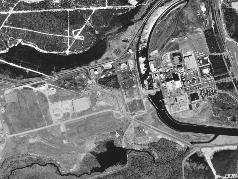
| Oyster Creek Nuclear Power Plant 1995 Lacey and Ocean Townships, New Jersey USGS photo 29 Mar 1995
|
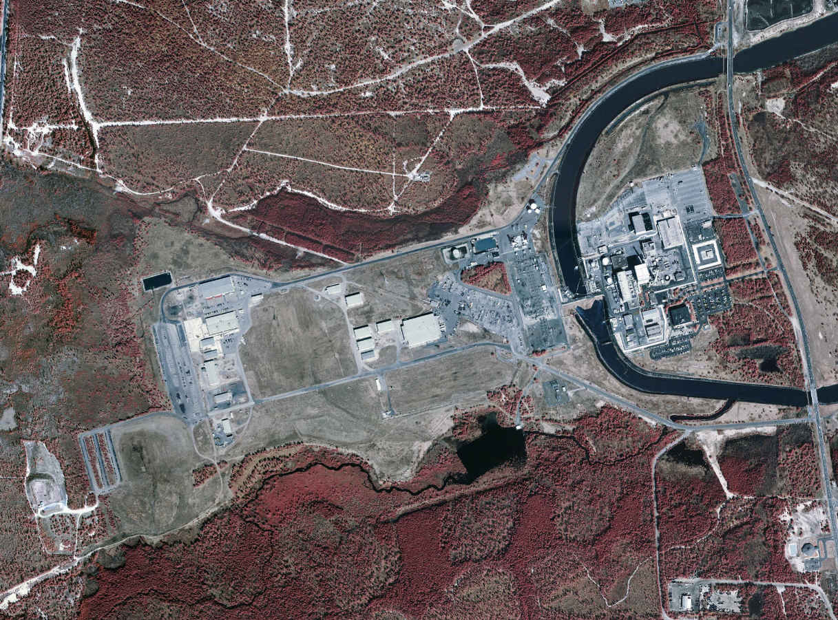
| Oyster Creek Nuclear Power Plant 2002 USGS photo (Made available on April 5, 2004; reduced to match photo above) http://seamless.usgs.gov
|
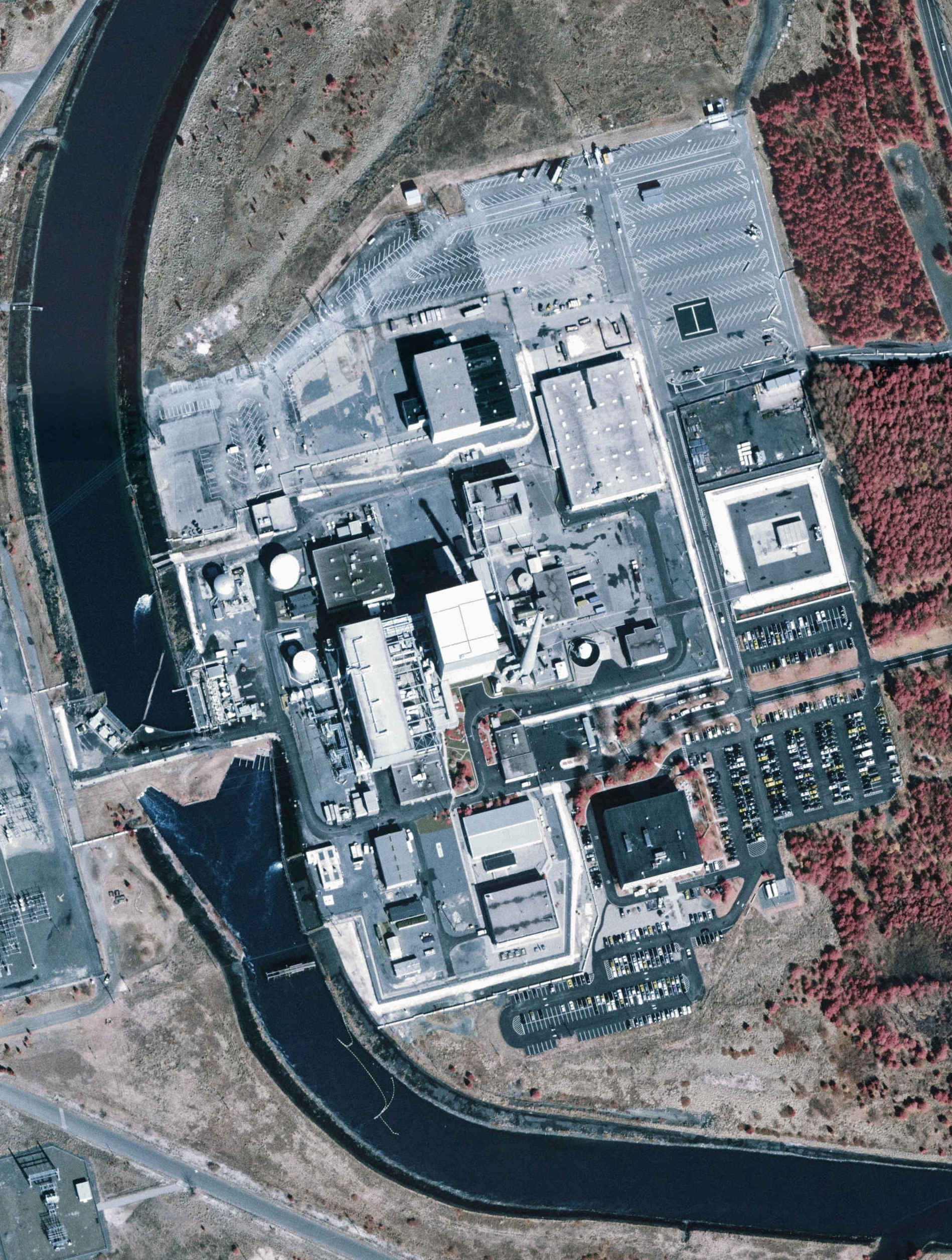
| Oyster Creek Nuclear Power Plant 2002 USGS photo (Full size, made available on April 5, 2004) http://seamless.usgs.gov
|