![[Image]](nmic2-map.jpg)
Source
|
This file is available on a Cryptome DVD offered by Cryptome. Donate $25 for a DVD of the Cryptome 10-year archives of 35,000 files from June 1996 to June 2006 (~3.5 GB). Click Paypal or mail check/MO made out to John Young, 251 West 89th Street, New York, NY 10024. Archives include all files of cryptome.org, cryptome2.org, jya.com, cartome.org, eyeball-series.org and iraq-kill-maim.org. Cryptome offers with the Cryptome DVD an INSCOM DVD of about 18,000 pages of counter-intelligence dossiers declassified by the US Army Information and Security Command, dating from 1945 to 1985. No additional contribution required -- $25 for both. The DVDs will be sent anywhere worldwide without extra cost. | |||
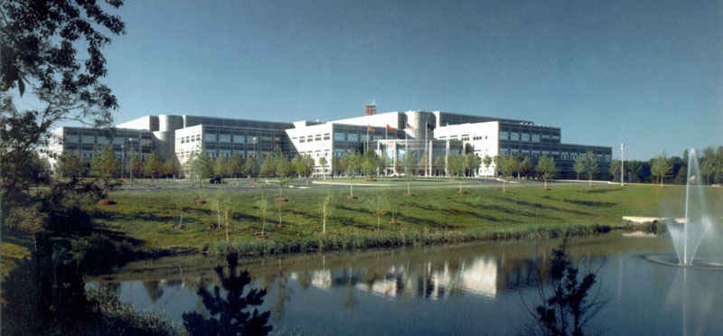
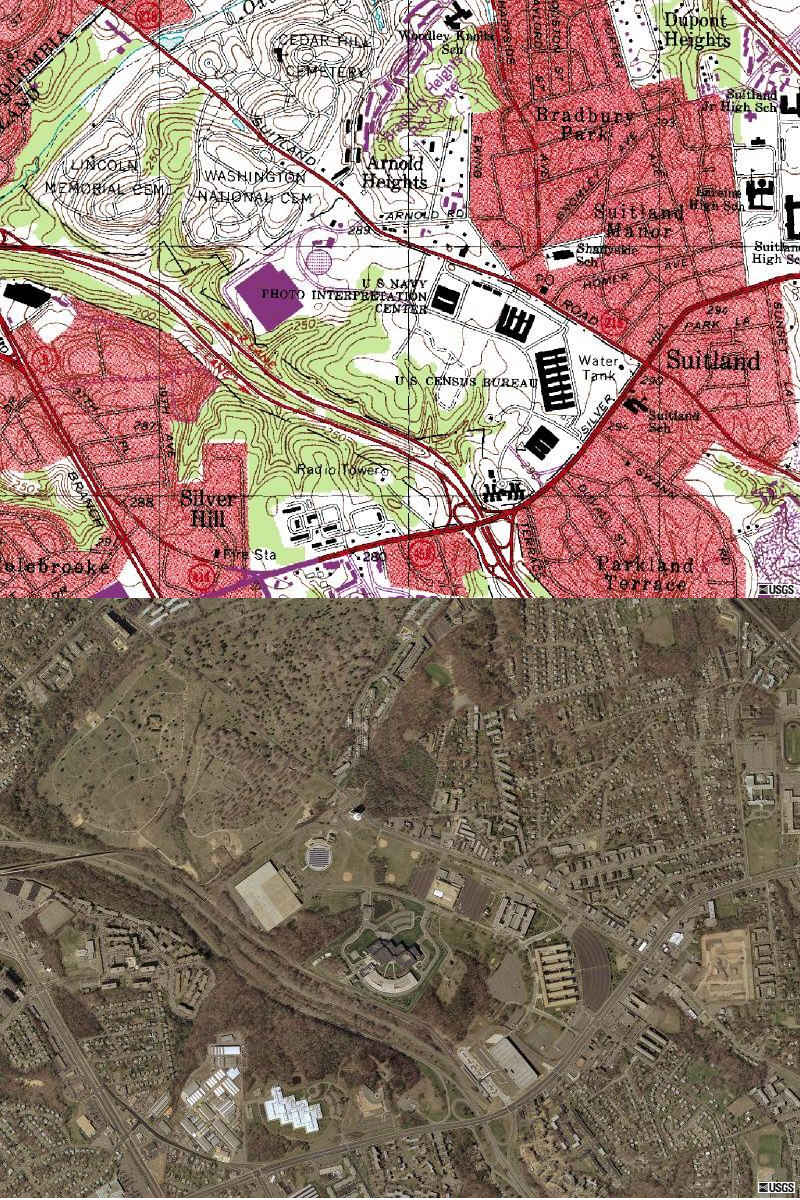
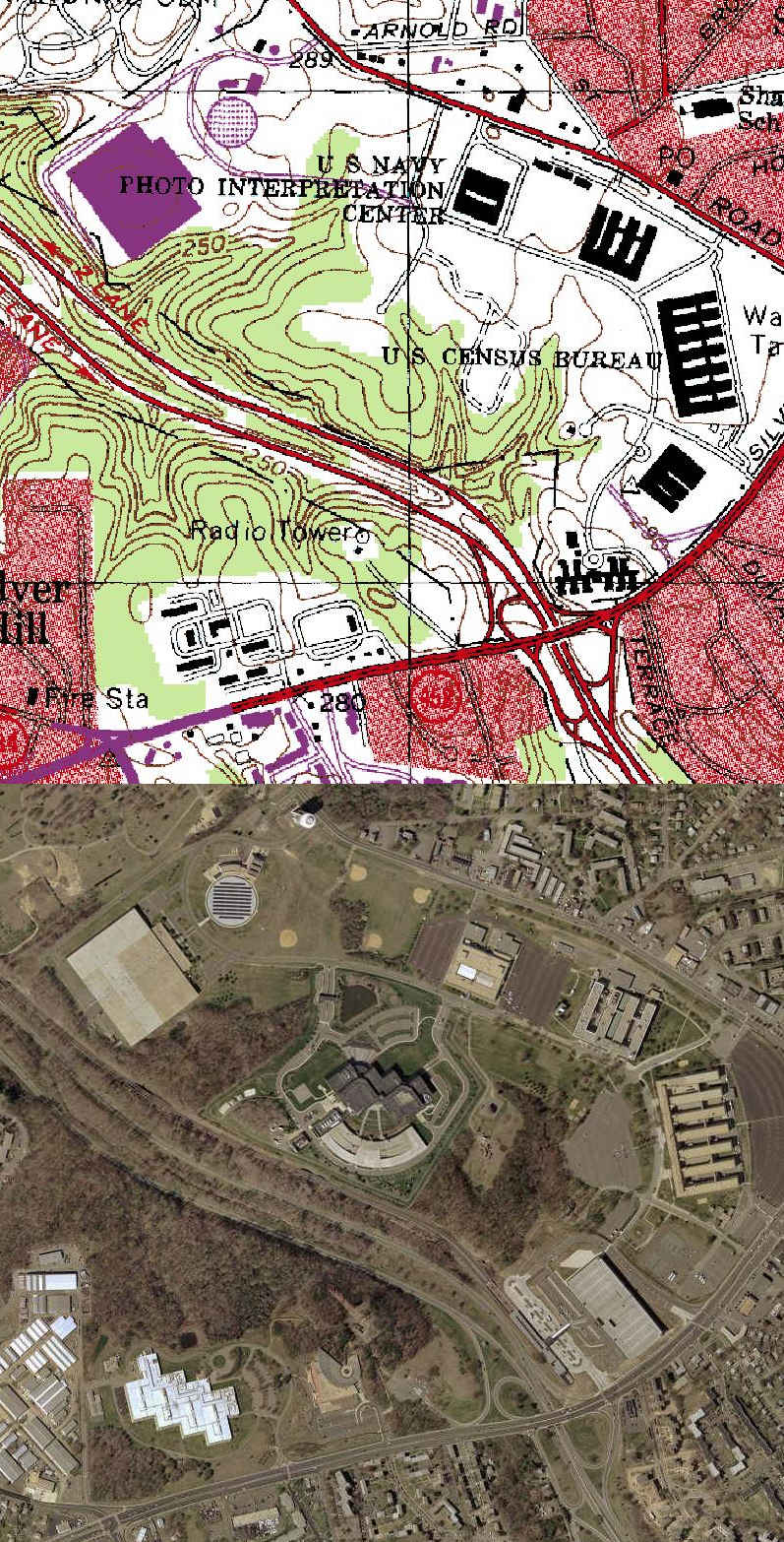
4 June 2004. A. reports that the facilities are those of the National Maritme Intelligence Center and Census Bureau, and points to this map:
National Maritime Intelligence Center (NMIC) is also known as the Office of Naval Intelligence (ONI):
http://www.nmic.navy.mil/history.htmLocated in the Federal Center in Suitland, Maryland, the National Maritime Intelligence Center, or NMIC, is the home and nerve center of ONI. NMIC also supports the United States Coast Guard Intelligence Coordination Center, the Naval Information Warfare Activity, and the Marine Corps Intelligence Activity.
See previous eyeball of the facility: http://cryptome.org/nmic-eyeball.htm
3 June 2004. Anonymous reports that these are National Reconnaissance Office facilities.
3 June 2004. One of the Eyeball series.
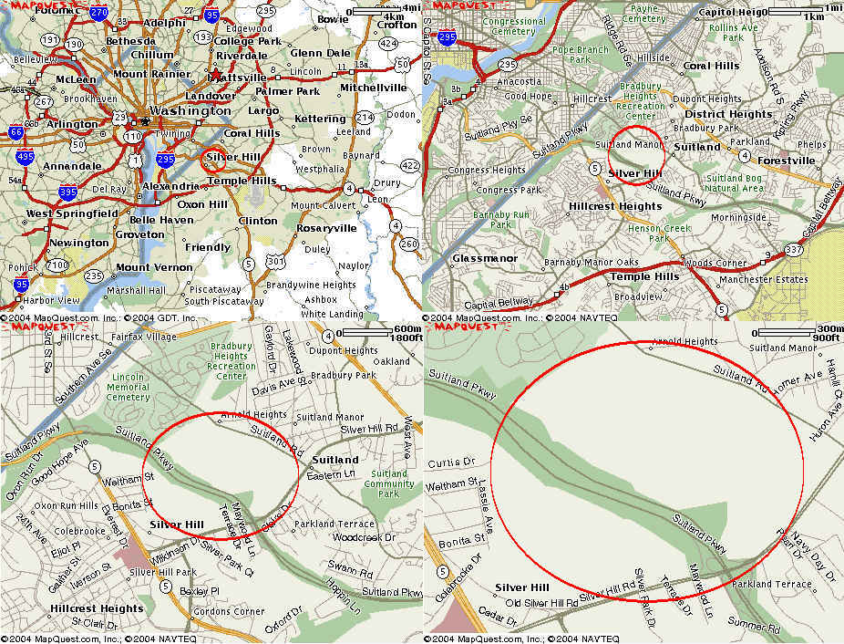
Maps from Mapquest.com
Source of photos:
http://www.terraserver-usa.com
Information on these facilities is welcomed. Send to: jya@pipeline.com
The Naval Photo Interpretation Center (NAVPIC) is reported to have been incorporated into the National Imagery and Mapping Agency which has been renamed the National Geo-spatial Intelligence Agency.
Unknown structures are:
1. The circular structure at upper left with dark bands -- map above shows it is the Central Heating and Refrigeration Plant. The dark bands are solar cells.
2. The securely-fenced and barricaded dark-roofed structure at the center -- map above shows it is the National Maritime Intelligence Center.
3. The sea-shell shaped structure at bottom center and adjoining antenna -- A. reports it is named the "Nautilus" and is a communications facility.
|
 |
| 4-meter resolution. USGS Photo, April 2002.
|
| 2-meter resolution. USGS Photo, April 2002.
|
| 1-foot resolution. USGS Photo, April 2002. http://seamless.usgs.gov
|