|
This file is available on a Cryptome DVD offered by Cryptome. Donate $25 for a DVD of the Cryptome 10-year archives of 35,000 files from June 1996 to June 2006 (~3.5 GB). Click Paypal or mail check/MO made out to John Young, 251 West 89th Street, New York, NY 10024. Archives include all files of cryptome.org, cryptome2.org, jya.com, cartome.org, eyeball-series.org and iraq-kill-maim.org. Cryptome offers with the Cryptome DVD an INSCOM DVD of about 18,000 pages of counter-intelligence dossiers declassified by the US Army Information and Security Command, dating from 1945 to 1985. No additional contribution required -- $25 for both. The DVDs will be sent anywhere worldwide without extra cost. | |||
21 May 2005. Thanks to R, add news report on military prison planned for this area:
http://home.hamptonroads.com/stories/story.cfm?story=86692ran=54843
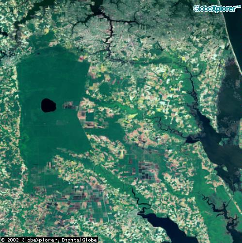
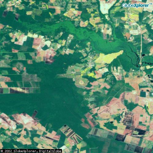
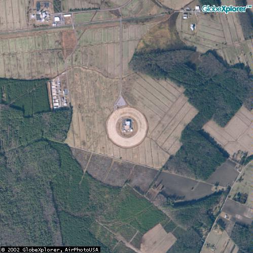
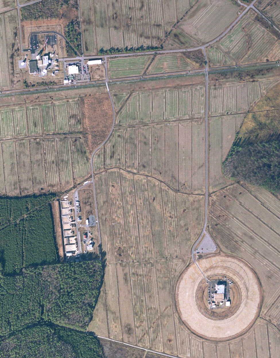
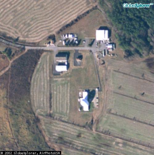
2 June 2002. Add aerial image:
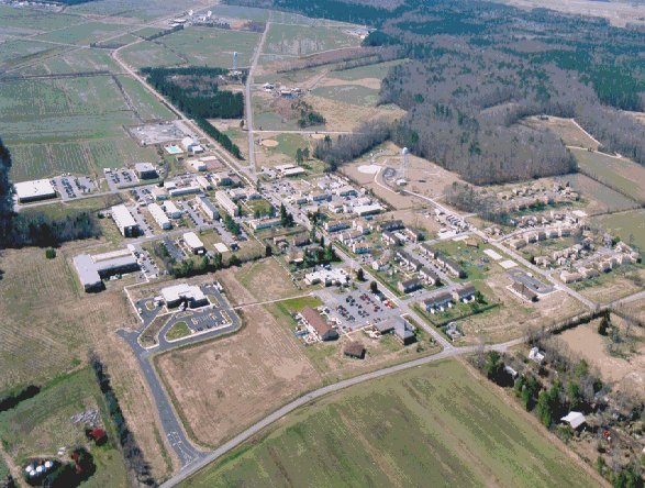
Circa 2001
Source:
http://www.geocities.com/the17seabee/northwes/images/northwest.jpg
See also history of the facility:
http://www.geocities.com/the17seabee/northwes/northwes.html
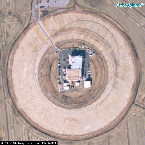
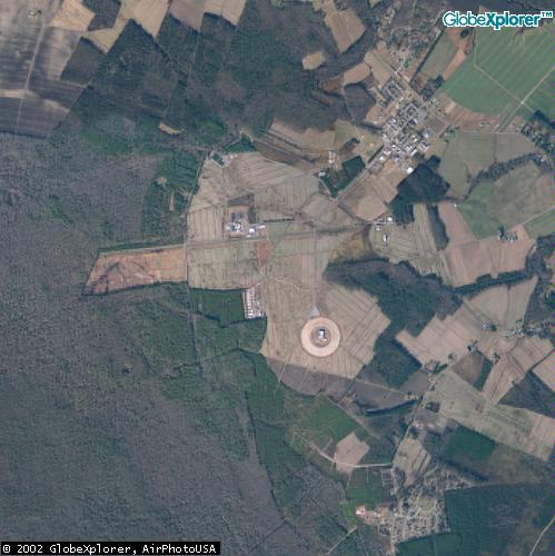
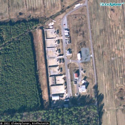
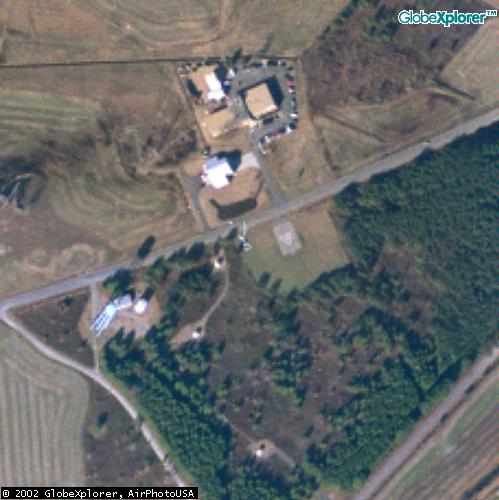
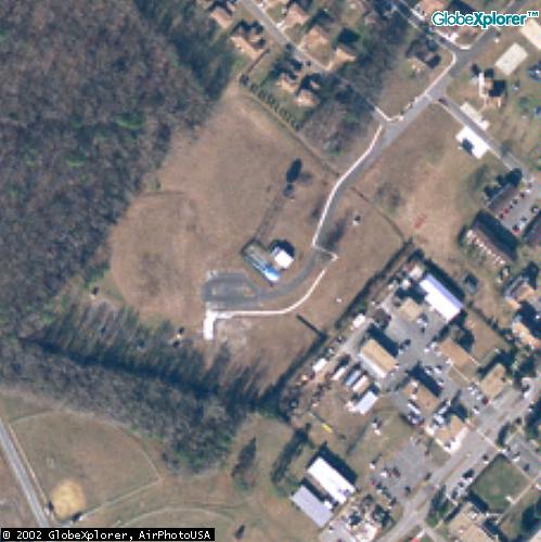
10 May 2002. Add three images of other antenna at the facility (at bottom right below).
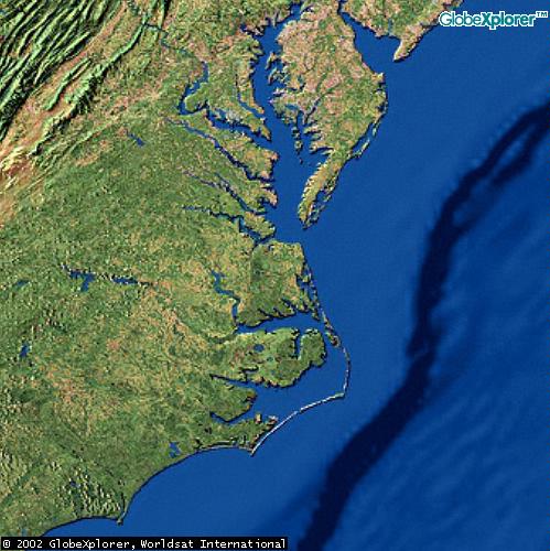
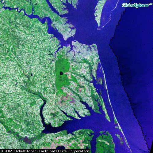
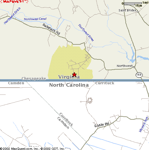
This facility is near Northwest, VA, and may be the one described by James Bamford in The Puzzle Palace (Penguin, paper, 1982):
By June the first watch list intercepts [for illegal drug-related activities] began flowing to the Bureau of Narcotics and Dangerous Drugs, and in September the special domestic targeting [of US civil rights and anti-Vietnam War protesters] had begun. Initially the monitoring was conducted from one NSA intercept site, but in December 1970 that station was closed. The operation began again in March at an NSA East Coast facility operated by the military, probably the Naval Security Group listening post just outside the little town of Northwest, Virginia, a swampy, snake-infested site bristling with $10 million worth of antennas. In 1975 the Security Group moved from the fourteen-hundred-acre site on the Virginia-North Carolina border to Sugar Grove, West Virginia. (p. 328.)
1 May 2002. Anonymous writes:
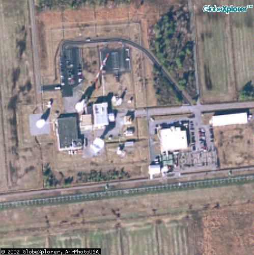
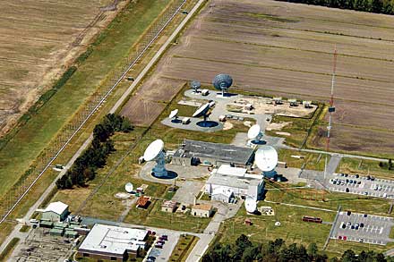
This is in regards to the antenna array you mention athttp://cryptome.org/moyock-eyeball.htm
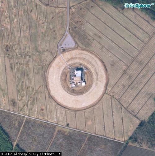
The circular array is called a CDAA or CDDA array (Circularly Diposed Antenna Array) and it is a common array used by the various intelligence agency for large scale, high bandwidth DF'ing (Direction Finding) where a particular signal is coming from.
The array is often called an "Elephant Cage" or "Dinosaur Cage" array. The site actually has six full arrays and you can see them if you look real close. These six arrays would make up three complete systems, although one of them appears inactive.
The antenna's are normally operated in multiple groups spread out over a wide distance. For example this station could be networked to similar ones in Australia, Turkey, and England so that each station can compare their readings with that received by the other stations.
Theoretically this kind of array can determine the angle of an incoming signal to within one degree, but in practice a resolution of 3 degree's is common. Now, if the array is networked with at least two other stations the emitter can be located to within just a few miles, and in some case to within just a few hundred feet.
OK, so we know what kind of an array it is, and we know that the US operates over a dozen of these "elephant cages" around the world.
Next, take a look at the size of the main building in the center of the array... the larger the buildings inside the array, and the greater the support areas (ie: parking spaces outside of the array) the greater the signal processing capability. In an optimal situation the signal processing equipment would be in an underground facility, with only support equipment above ground. The array on the very inside of the array would be used to cancel out the noise created inside the processing facilities, noise from car engines inside the array, and so on.
Note the parking lot just north of, and just outside the array, and count the parking spaces to determine how may people are assigned to the facility.
Inside the US the site would have a small Ku band satellite uplink nearby (at the north support facility), but the site will depend heavily on dual underground fiber optic runs back to a phone company facility. This cable run is fairly easy to locate on overhead imagery as the area would have been trenched recently and would run on a tangent between a nearby utility point on one of the nearby roads, and the facility. Outside the US the Ku band satellite uplink will be much larger as the site would be less dependent on local fiber optics.
While this kind of site COULD be used for eavesdropping such use is impractical, and the sites are simply used to determine the LOCATION of a transmitter. An actual intercept (from a station really close the transmitter) would get location coordinates from a network of the multiple CDAA DF stations. Again let me point out that actual interceptions are best when performed really, really close to the target (and not from a DF array on the other side of the globe).
The height of the array, and the distance between the concentric circles tell us the frequency range that is being monitored for DF coordinates. In this case the site would appear to have capabilities between 2 MHz and 50 MHz, but perhaps even as high as 80-110 MHz or higher. On the low end the site could be used down as low as 100 kHz or 500 kHz but the performance would be poor.
Given the size of the processing facility, and the support buildings it is safe to assume that the station is a "real time wide band DF station" in that sucks in the entire HF spectrum and provides near instantaneous coordinates of anything that appear on the spectrum for even a fraction of a second. Combine this with the information from a half dozen similar stations operating in real time, and the intelligence collected from actual intercepts and it is virtually impossible to hide a RF transmission.
If a division of tanks in India suddenly lights up with radio traffic, a network of CDAA systems would be able to track the movements of the tanks to within just a few hundred feet. Intercept operators near India would then be tasked to monitor/intercept the actual radio traffic while the DF stations (some distance away) provided locations. Add to this the real time high resolution overhead imagery shot from UAV's, reconnaissance planes, and satellites (all getting their targeting coordinates from the network CDAA arrays). By combining the DF coordinates, actual intercepts, and imagery not only would the US know where the tanks were, they would know what kind of tanks they were, what kind of weapons where being moved, and what their intentions where.
1 May 2002. B. writes:
"Moyock" is a Naval Security Group facility: its actual name is Naval Security Group Activity (NSGA) Northwest. The large circularly disposed antenna array is an AN/FRD-10, and its purpose is radio interception and high-frequency direction-finding (HF-DF). The site is or was part of the NSG's BULLSEYE HF-DF net, more recently called the CROSSHAIR net. According to this note the Northwest array has recently been dismantled:http://www.anzwers.org/free/navyscpo/end_of_an_era_nw_va.htmlThe big circles at Sugar Grove also used to contain FRD-10s, but I think those ones have been scrapped too. Many FRD-10 sites have been closed, both in the US and around the world (the two Canadian sites, Masset and Gander, are still operating, however). If you want to eyeball the whole US set, I think the current operational list is NSGA Winter Harbor, MA, NSGA San Diego, CA, NSGA Sabana Seca, PR, NSGA Wahiawa, HI.
There is also an array of some kind at Medina RSOC, possibly operated by NSGA Medina, but I can't tell from the overhead image what kind of array it is, and since the RSOC was originally an Air Force facility, it might be an AN/FLR-9, which seems to have been the array typically used by the Air Force. (There's a FLR-9 at Elmendorf, AK, and there are or were several others around the world, but I don't know if there are any in the CONUS.) More likely, the Medina array would be an AX-16 "Pusher", or some system like that, since the circle looks too small for a FLR-9.
Speaking of RSOCs, there are also RSOCs at Fort Gordon, GA and Kunia, HI and another RSOC or RSOC-like facility at Buckley ANG (Denver, CO).
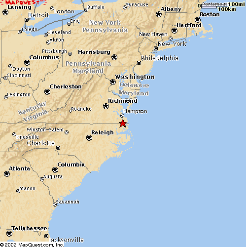
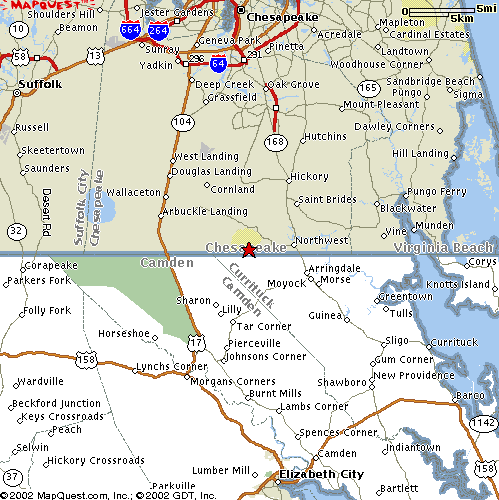
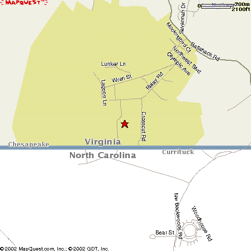
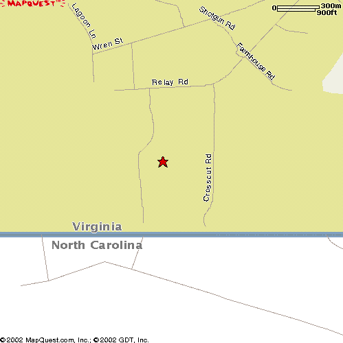
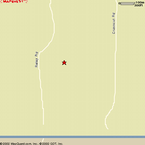
30 April 2002. Thanks to E.
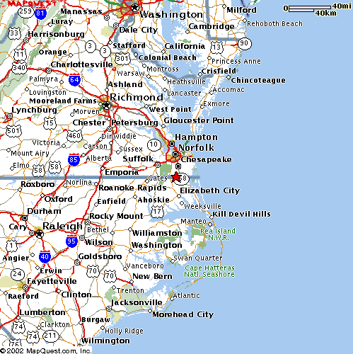
Source: Mapquest.com
This is a US Navy communications and interception facility, reportedly staffed by a Naval Security Group (Navsecgru) which also staffs several worldwide Echelon stations.
Note the cylindrical radio antenna around the facility.

1982 topographical map (Terraserver)
|
 |
 |
 |
 |
 |
 |
 |
 |
 |
 |
 |
 |
 |
 |
 |
 |
 |
 |
|
2005 aerial view: |
|
 |
 |
 |
 |
