|
This file is available on a Cryptome DVD offered by Cryptome. Donate $25 for a DVD of the Cryptome 10-year archives of 35,000 files from June 1996 to June 2006 (~3.5 GB). Click Paypal or mail check/MO made out to John Young, 251 West 89th Street, New York, NY 10024. Archives include all files of cryptome.org, cryptome2.org, jya.com, cartome.org, eyeball-series.org and iraq-kill-maim.org. Cryptome offers with the Cryptome DVD an INSCOM DVD of about 18,000 pages of counter-intelligence dossiers declassified by the US Army Information and Security Command, dating from 1945 to 1985. No additional contribution required -- $25 for both. The DVDs will be sent anywhere worldwide without extra cost. | |||
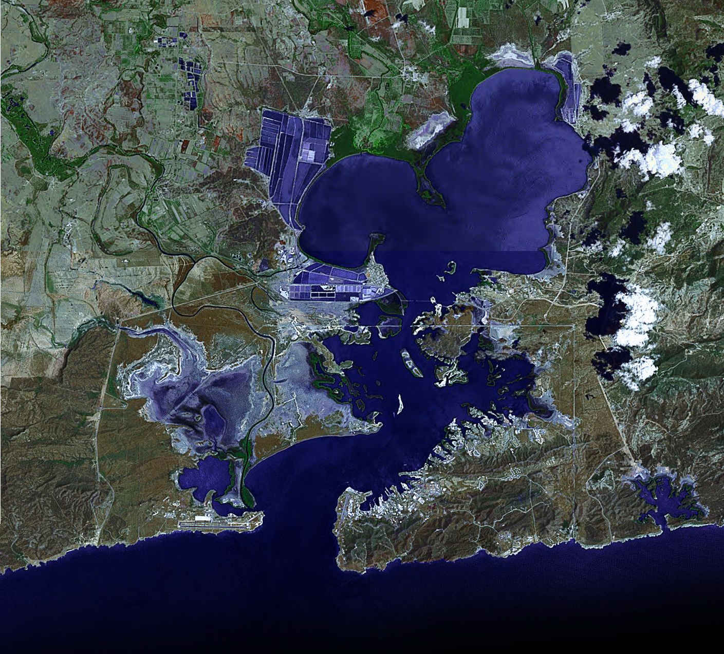
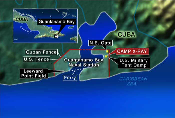
19 April 2005. Add Google satellite photo.
| www.maps.google.com
|
23 October 2003. One of the Eyeball
series.
Source of photos and maps as indicated.
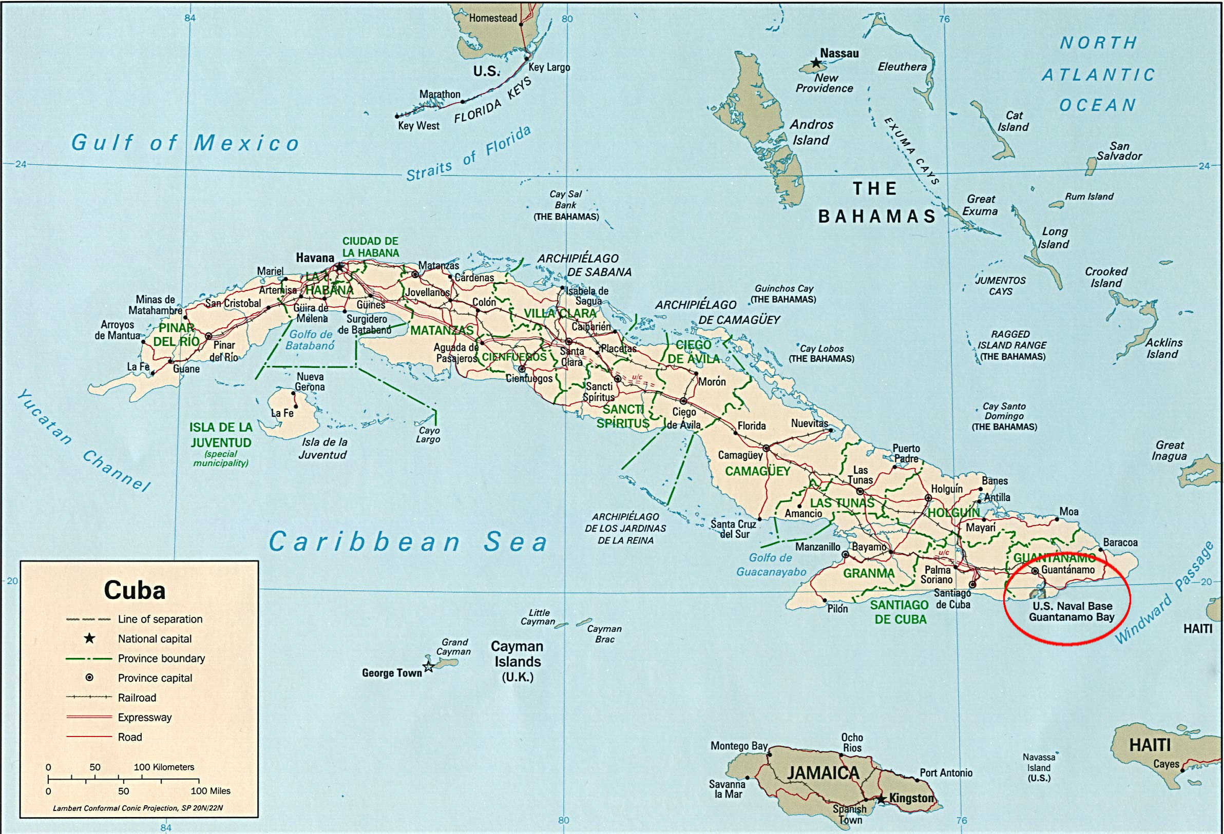
US Naval Station Guantanamo Bay: http://www.nsgtmo.navy.mil/
MissionNaval Base Guantanamo Bay is on the front lines of the battle for regional security and protection from drug trafficking and terrorism, and protection for those who attempt to make their way to through regional seas in un-seaworthy craft.
The base protects the ability of US Navy and Coast Guard ships to operate in the Caribbean operating area with supplies and support for their operational commitments. During the past year Naval Base Guantanamo Bay has become the host to the Detainee Mission of the War on Terrorism following the September 11, 2001 terrorist attacks.
The base has a unique posture in the Western Hemisphere in that it is the oldest US base outside the continental U.S. and the only one in a country that does not enjoy an open political relationship with the United States.
More on Gitmo: http://www.globalsecurity.org/military/facility/guantanamo-bay.htm
Camp X-Ray: http://www.globalsecurity.org/military/facility/guantanamo-bay_x-ray.htm
|
||||||
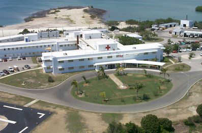
 Source |
||||||
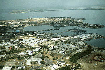
 Source |
||||||
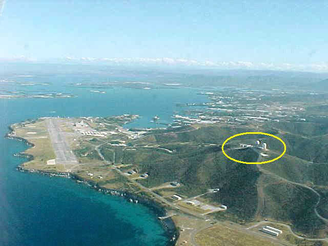
 Source |
||||||
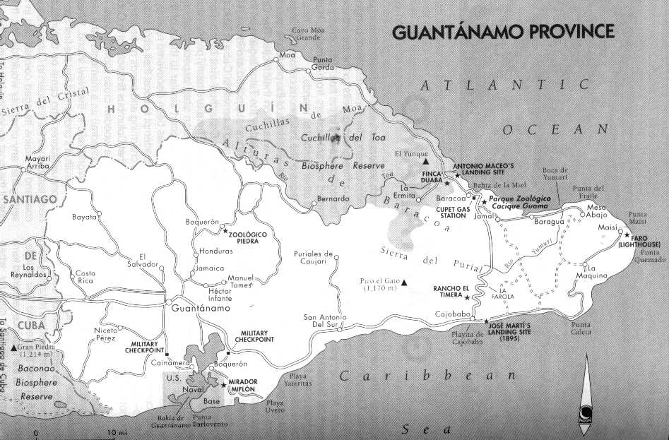
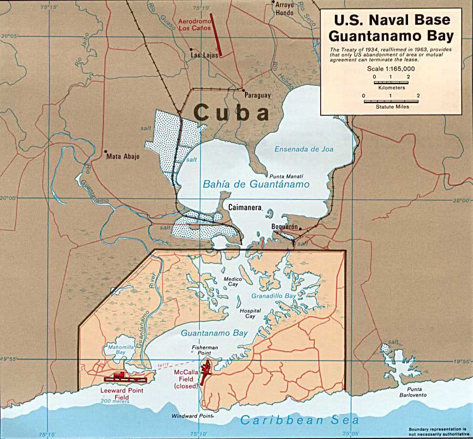
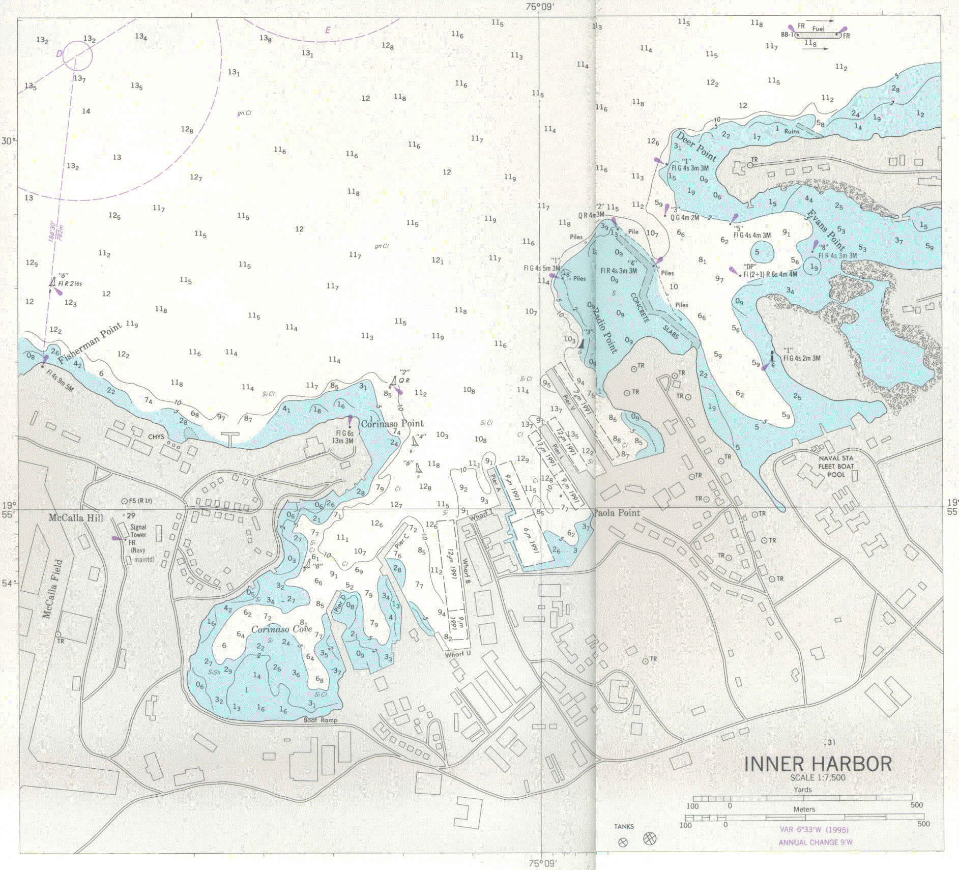
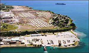
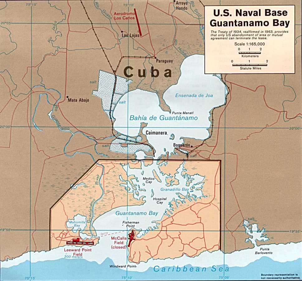
 Source: Excerpted from hardcopy of US Defense Mapping Agency Nautical Chart No. 26218, 1996 |
||||||
|
Source: Excerpted from hardcopy of US Defense Mapping Agency Nautical Chart No. 26100, 1996 |
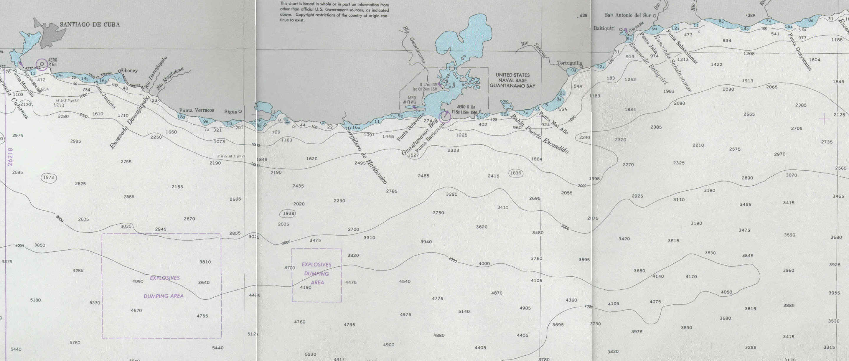
Source: Excerpted from hardcopy of US Defense Mapping Agency Nautical Chart No. 26218, 1996 |
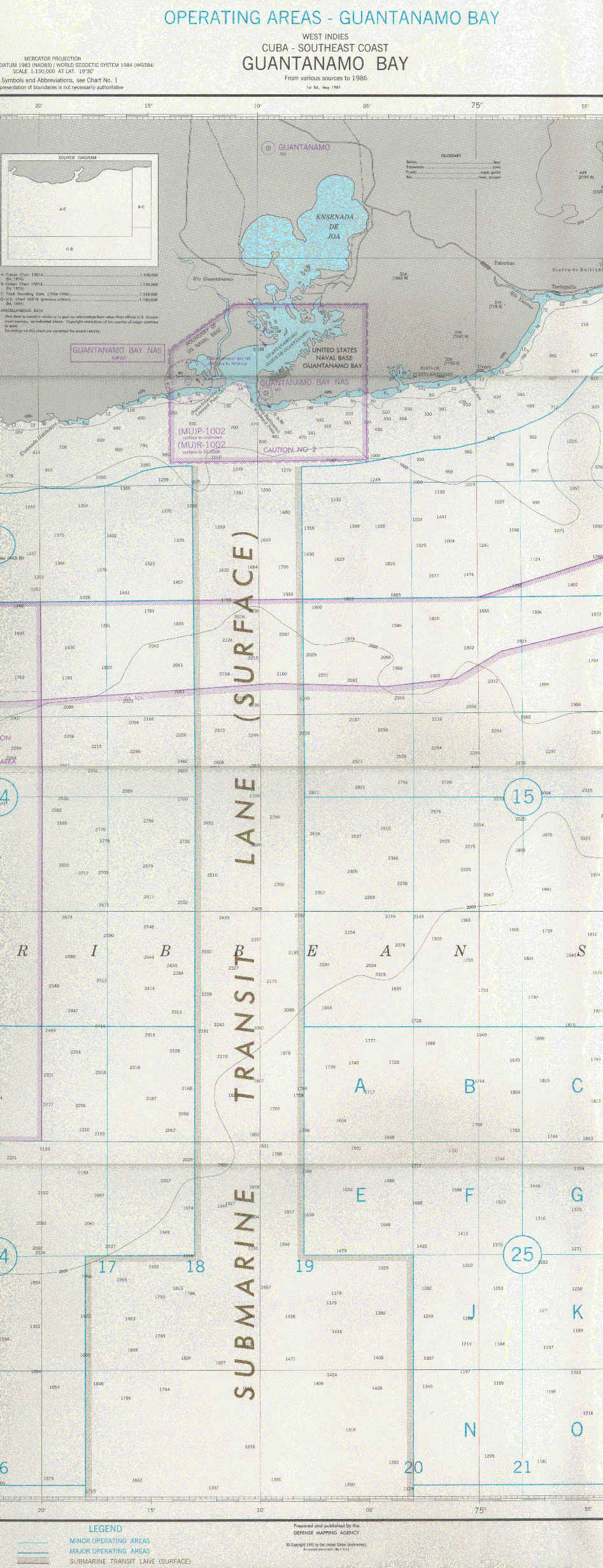
Source: Excerpted from hardcopy of US Defense Mapping Agency Nautical Chart No. 26229, 1996 |
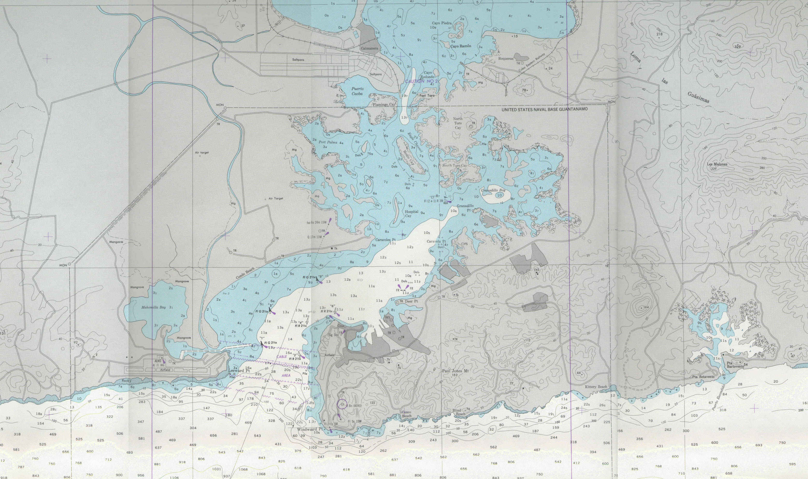
Source: Excerpted from hardcopy of US Defense Mapping Agency Nautical Chart No. 26230, 1996 |
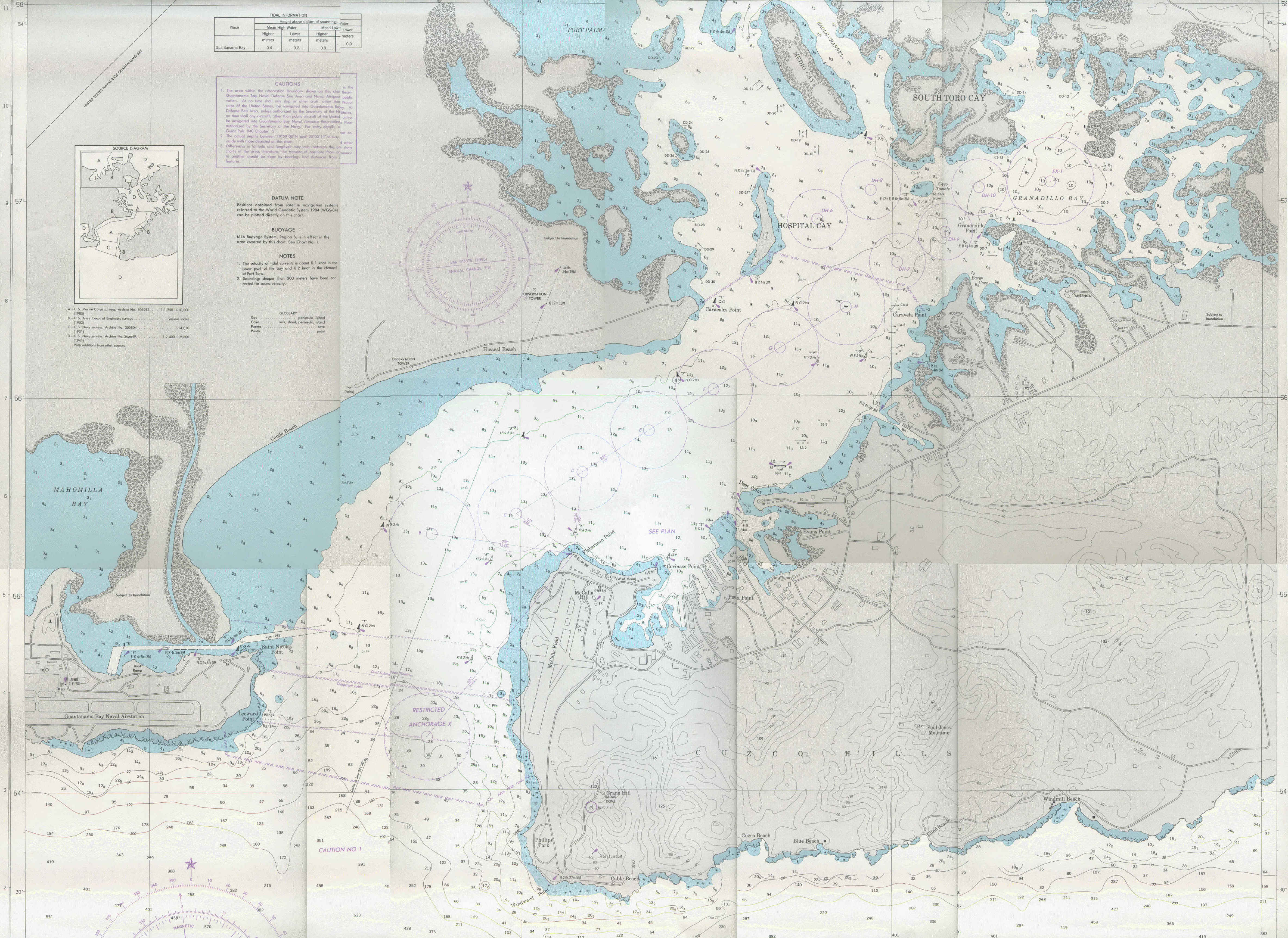
Source: Excerpted from hardcopy of US Defense Mapping Agency Nautical Chart No. 26230, 1996 |